The Vermilion Lighthouse
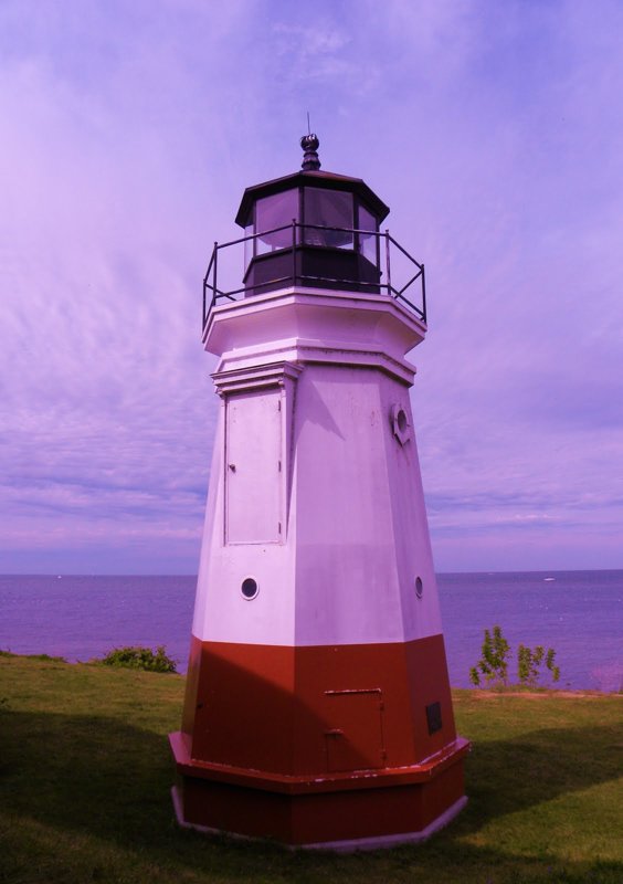 The Vermilion Lighthouse is a replica of the original lighthouse that was later moved to Lake Ontario. Known as the "Town of Sea Captains," Vermilion was without a lighthouse for 63 yrs. The lighthouse is located next to Main Street Beach in downtown Vermilion, Ohio.
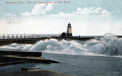 Inhabited by the Erie Indians as early as 1656, Vermilion had grown large enough by the mid-nineteenth century for its harbor to warrant government maintenance. In 1847, Congress appropriated $3,000 to build a lighthouse and prepare the head of the pier on which it would be built. Before 1847, the people of Vermilion had constructed their own navigational aid: wooden stakes topped with oil-burning beacons at the entrance of the harbor.
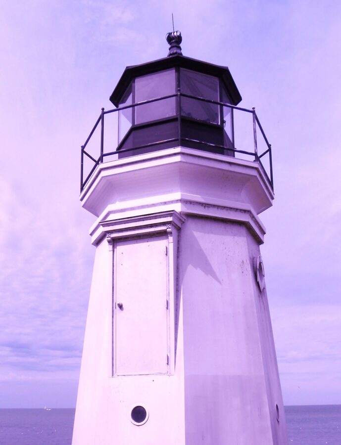 The 1877 lighthouse performed its duties faithfully for over half a century, shining its light for both commercial and pleasure boats. During this time, it was moved closer to the end of the pier (25 feet from the outer end), and survived multiple collisions with watercraft. Eventually it was put under the care of Lorain Lighthouse’s assistant keeper, and in the early 1920s, the Vermilion keeper’s home was sold to the local Masonic Lodge.
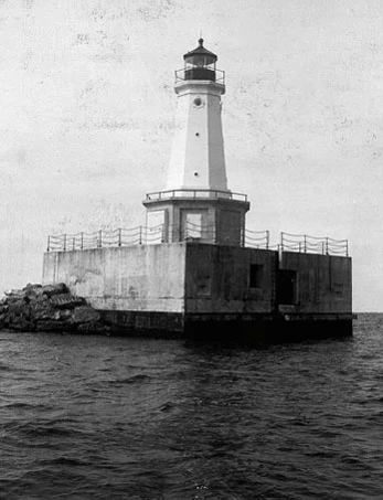 Shortly after their new light was built, the residents of Vermilion learned what had become of their original lighthouse. Amazingly, the structure had not been destroyed after its removal. In fact, it was still shining, and had been for the last 59 years.
Vermilion River & Lake Erie
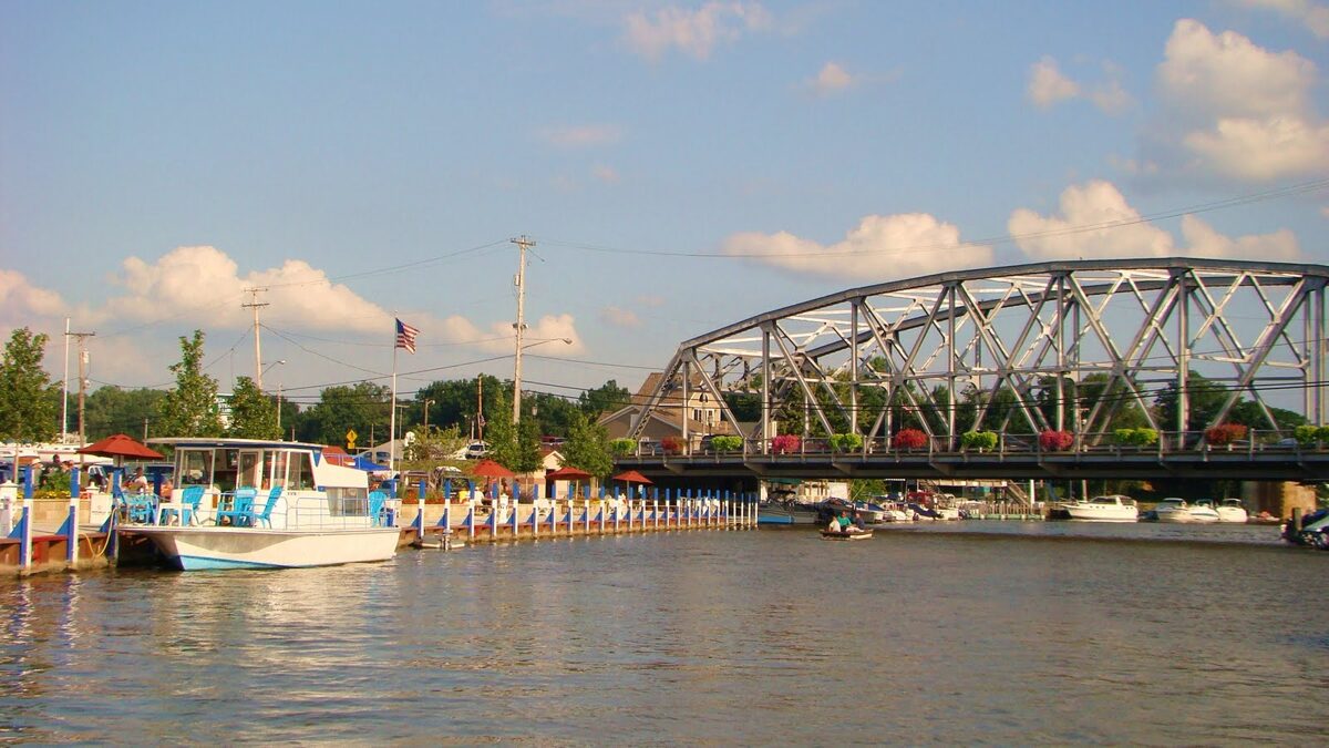 The Vermilion River, which flows into Lake Erie, endows marina facilities with more than 1,000 boat slips and ramps for easy access to the Lake, earning Vermilion the title of the “Largest Small Boat Harbour on the Great Lakes.” Lake freighters are a regular sight on Lake Erie making their way through the Great Lakes.
Lake Erie is the 10th largest lake on Earth. It is bounded on the north by the Canadian province of Ontario, on the south by the U.S. states of Ohio, Pennsylvania, and New York, and on the west by the state of Michigan. The lake is named after the Erie tribe of Native Americans who originally lived along its southern shore.
Ohio Magazine chose Vermilion, Ohio at the "Best Port Stroll" in Ohio. The wealth of attractions so close to protected dockage makes Vermilion a very popular cruising destination. Rare is the port of call with as much to offer.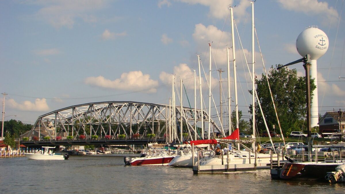 Several Vermilion marinas and boating supply stores cater to your nautical needs. The Vermilion Marine Business Association members offer a wide array of services to meet the needs of the boating public.
The Vermilion Port Authority invites you to visit our Vermilion Public Guest Docks. You are in the center of Vermilion's historical district and within easy walking distance of many quaint specialty shops, groceries, ice, restaurants, fast food, historical homes, overnight accommodations, professional services and the Main Street Beach.
Swimmers of all ages enjoy our sandy beaches located in Historic Downtown Vermilion. Recreational boating of every kind, jet skis, canoeing, and sail boats adorn the Vermilion harbor, where ship building was once the major industry.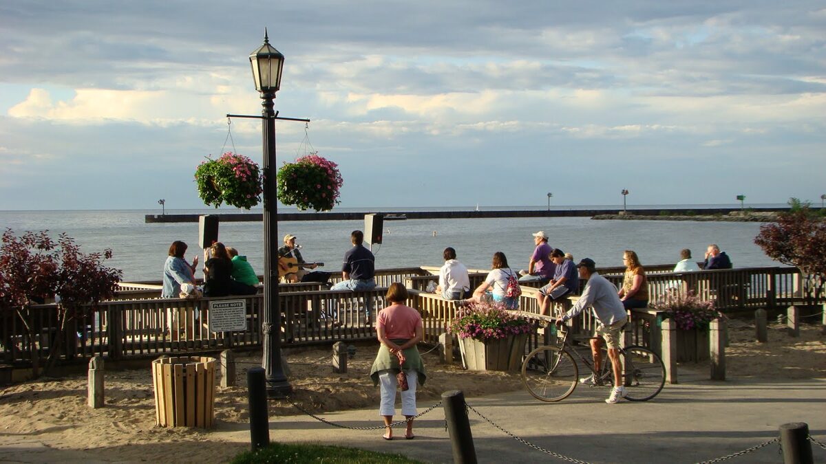 On summer nights, residents and visitors congregate on the large deck at Main Street Beach to watch boats sail back and forth in front of the beautiful Lake Erie sunset and enjoy the Mystic Belle, a small paddle wheeler, offering rides on the Vermilion River. Also, in the summer the children of our community attend Sail Camp where they learn water safety and sailing supervised by members of our world-renowned women’s sailing crew, Team Flamingo, winners of the Japanese Invitational J24 in 1994 in Japan.
Lake Erie Shores & Islands is the Midwests hottest, most exciting vacation destination. Located on the southern shore of Lake Erie, the area offers all the calm and relaxation of a coastal vacation as well as many exciting and diverse amusements to please the whole family. Located halfway between Toledo & Cleveland, on the southern shore of Lake Erie, Lake Erie Shores & Islands offers so many attractions for the whole family! From amusement parks, to museums, to watersports, to natural areas and more - everyone will find a great reason to...Explore the Shore Next Door!
 Lake Erie Islands
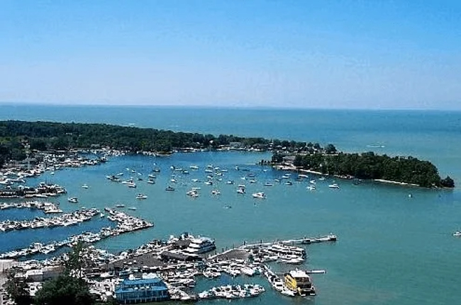
Did you know you could escape to an island, just off the shores near Vermilion? The islands are a Midwest vacation hot spot. Just a short drive to a ferry ride from the mainland, or visit by boat, and you'll forget you are in Ohio! Whatever your pleasure, coastal relaxation or on-the-go excitement, the islands have got it covered! And it's all just minutes away from historic Vermilion, Ohio.
Kelleys Island, listed on the National Register of Historic Places, is an outdoor-lovers paradise, while Put-in-Bay, on South Bass Island, appeals with abundant shopping and entertainment. You can also visit Middle Bass Island, which is dominated by vineyards, old homes, summer cottages, and a campground. Canada's Pelee Island is also accessible by ferry from Sandusky, but does require planning for an overnight stay - the ferry visits Sandusky only once a day in peak season.
The Lake Erie Islands can only be reached by boat or plane. Cars are permitted on all the islands; however, you’ll have greater freedom to discover each island’s natural beauty by bicycle or golf cart. Rental shops are located within walking distance of the islands’ ferry docks.
Kelleys Island
Kelleys Island is a nature-lovers’ paradise, whose modest commercial development lends to its appeal. Rent bicycles or golf carts to explore the scenic countryside, visit the largest prehistoric glacial grooves in existence, catch a bite to eat at an island eatery, or simply lounge at the Kelleys Island State Park beach. The island’s appeal ranges from natural spaces to rousing nightlife. Birds, wildlife, and hiking trails are abundant,. Enjoy miniature golf, volleyball, horseshoes, one-of-a-kind island shops and confectioneries, and making memories that will last a lifetime.
South Bass Island (Put-in-Bay)
Put-in-Bay is a colorful, Victorian village on South Bass Island . Nightlife and live entertainment rule the summer weekends on this festive island, with national and regional musical acts and comedians. The island boasts a waterfront park, unique shops, eateries, and historical attractions. Explore caves, take a spin on a carousel, and sample the local vintage. Don’t miss Perry’s Victory and International Peace Memorial, a 353-foot Greek Doric column that is the second tallest free-standing monument in the U.S. It commemorates Commodore Oliver Hazard Perry’s defeat of the British in the 1813 Battle of Lake Erie and stands as a memorial celebrating lasting peace between the U.S. and Canada . Take the elevator to the observation platform for a spectacular view.
Middle Bass Island
Explore this island dominated by vineyards, old homes, summer cottages, and a campground. There are few man-made diversions here; instead, many attractions are nature-made: a rocky shoreline, expansive views, and interior wetlands. The Kuehnle Wildlife Area protects a variety of plants and animals. Its 20-acre pond is a favorite spot with bird watchers and fishermen. Still in development, the new Middle Bass Island State Park currently provides limited marina facilities and hiking trails.
Just minutes from Vermilion, discover the Lake Erie Islands.
The History Of Juneteenth
 Juneteenth is the oldest known US celebration of the abolition of the chattel slave system, and the emancipation of enslaved African Americans in Texas.
The question of slavery divided the nation during the decades leading up to the Civil War. But by September of 1862, President Abraham Lincoln made abolition a formal position of the US government when he announced the Emancipation Proclamation, which declared that enslaved people in states or areas of “rebellion against the United States” would be free effective on January 1, 1863. However, the proclamation was not enforceable in those slaveholding areas for which it applied.
Nevertheless, as Union troops moved through the South, they brought the news of emancipation with them and the ability to enforce the order through military might. Further encouraged by the proclamation, large numbers of enslaved African Americans self-liberated, escaping chattel slavery to seek refuge behind Union lines when geographically feasible. Many of these freedom seekers joined the US Army and Navy to fight as United States Colored Troops throughout the remainder of the Civil War.
Two years later in April 1865, Confederate General in Chief Robert E. Lee surrendered to Commanding General Ulysses S. Grant of the US Army after the Battle of Appomattox Courthouse in Virginia. While this is often viewed as the effective end of the US Civil War, in parts of the Trans-Mississippi West the war had yet to conclude. Well into May 1865, battles between federal troops and Confederate forces continued in Texas. It was not until June 2, 1865, that Confederate General Edmund Kirby Smith finally surrendered the Trans-Mississippi West to US forces.
On June 19, 1865, US Brigadier General Gordon Granger and his troops landed at Galveston, Texas confirming the news that the Civil War had ended and that enslaved African Americans were now free. Prior to Granger’s arrival, the US military presence in Texas was too weak to enforce President Lincoln’s 1863 Emancipation Proclamation. Two months after General Lee’s surrender in Virginia, Union forces were strong enough to act as a liberating force for enslaved African Americans throughout the state.
In the years before Granger’s landing, news of the proclamation was slow to reach Texas, and did not reach some quarters at all. In other places, the news was hidden by slaveholders to preserve slavery. One of Granger’s first acts was to announce freedom for African Americans; many left Texas immediately for the North or to search for family in other slaveholding states. Even freedom seekers with no fixed destination left their place of bondage, if for no other reason than to grasp freedom for the first time.
The Juneteenth celebration grew during the years following the Civil War, with many formerly enslaved African Americans and their descendants making annual anniversary pilgrimages to Galveston.
Although the ratification of the 13th Amendment to the U.S. Constitution in December 1865 ultimately abolished slavery in all areas of the nation, Juneteenth captured the jubilation of the end of slavery in the Confederacy. In 1980, Juneteenth became an official state holiday in Texas and was adopted by 45 states and the District of Columbia. Juneteenth is now a federal holiday in the United States commemorating the emancipation of enslaved African-Americans.
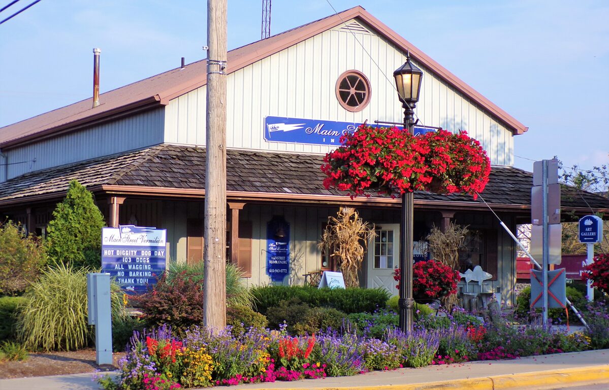
Helping Vermilion Bloom
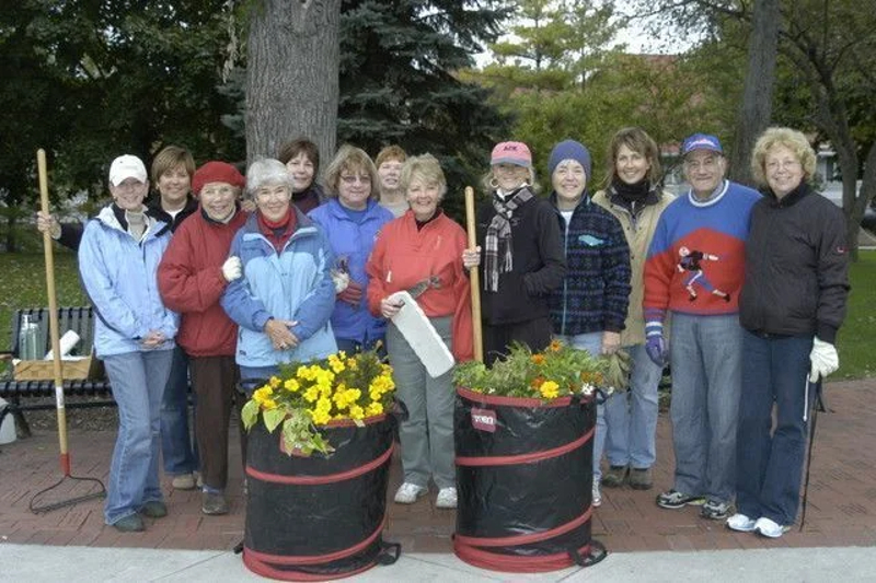 Since 2003, Vermilion in Bloom has changed the way our town looks by brightening the streetscape throughout downtown with flowers, improving public gathering places, coordinating the addition of "urban friendly" trees, dressing the town for the holidays and so much more. Their work delivers a sense of pride as visitors and residents alike marvel at the sight, even stopping to say "thanks" to the daily watering crews for their volunteerism.
There are more than 100 volunteers who help in many ways: planting flower baskets and beds, tending plantings, daily watering crews, light maintenance, cooking and baking for the popular Ladies Night and more.
Would you like to be a part of this fun and dedicated group? Fill out the online form and a member of the VIB team will be in touch as soon as possible: https://www.mainstreetvermilion.org/vermilion-in-bloom-inquiries
The History Of Flag Day
 Each year on June 14, we celebrate the birthday of the Stars and Stripes, which came into being on June 14, 1777. At that time, the Second Continental Congress authorized a new flag to symbolize the new Nation, the United States of America.
The Stars and Stripes first flew in a Flag Day celebration in Hartford, Connecticut in 1861, during the first summer of the Civil War. The first national observance of Flag Day occurred June 14, 1877, the centennial of the original flag resolution.
By the mid 1890's the observance of Flag Day on June 14 was a popular event. Mayors and governors began to issue proclamations in their jurisdictions to celebrate this event.
In the years to follow, public sentiment for a national Flag Day observance greatly intensified. Numerous patriotic societies and veterans groups became identified with the Flag Day movement. Since their main objective was to stimulate patriotism among the young, schools were the first to become involved in flag activities.
In 1916 President Woodrow Wilson issued a proclamation calling for a nationwide observance of Flag Day on June 14. It was not until 1949 that Congress made this day a permanent observance by resolving "That the 14th day of June of each year is hereby designated as Flag Day . The measure was signed into law by President Harry Truman.
Although Flag Day is not celebrated as a Federal holiday, Americans everywhere continue to honor the history and heritage it represents.
Join Vermilion Arts Guild
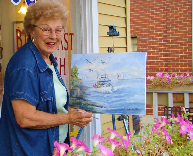 Art and creativity play an important part in historic downtown Vermilion. The Main Street Vermilion Arts Guild inspires and encourages artistic expression through their members — all local artists and craftsmen who display their work at the gallery inside the Main Street Vermilion Building at 685 Main Street. The gallery features watercolors and acrylics, photography, original jewelry, woodworking, ceramics and pottery, and more. Artwork changes with each approaching season.
During show dates, the Vermilion Arts Guild Gallery is open Monday thru Friday from 10 am to 4 pm and Saturday and Sunday from 12 pm to 4 pm. Look for these special shows featuring original works of arts from local artists and fine craftsmen. Shows change seasonally.
The Vermilion Arts Guild series of workshops is designed for a variety of skill levels and interest in mediums. Taught by experienced members of the Guild, the workshops are conducted on Saturdays. You're encouraged to bring a lunch or order carry out at one of Vermilion's local restaurants. Workshops are held at the Main Street Building at 685 Main Street. There's lots of parking in nearby city lots.
If you are interested in joining the Vermilion Arts Guild, please complete the online form with your information at https://www.mainstreetvermilion.org/artsguildapplication
In order to become a member of the Arts Guild you must:
- Meet with the Show and Membership Committees for orientation and go over by-laws, information, and expectations.
- Have artwork (all mediums) juried at an Arts Guild Meeting (these occur the third Monday in March, June, September and November at 7 pm in the Main Street Building).
- If your artwork is accepted, you must become a member of Main Street Vermilion.
- Share in working shifts at different Art Shows throughout the year.
- Attend a minimum of two Arts Guild meetings each year and/or participate on a committee.
Historic U.S. Route 6 Signs
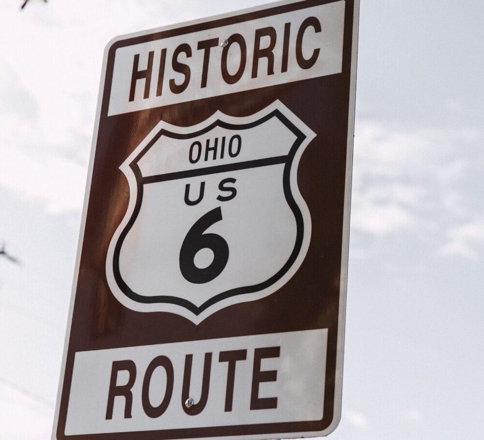 Historic U.S. Route 6 signs installed on the east and west entrances of historic downtown Vermilion celebrate U.S. Route 6 as the oldest, longest and highest of the "old roads". The historic highway is 3,652 miles long, with a high point of 11,990 feet. It runs from the waterfront in Long Beach, California through 14 states, to the waterfront at Provincetown, Massachusetts located at the tip of Cape Cod.
The signs were a project of U.S. Route 6 Tourist Association and were funded by Main Street Vermilion and installed by the City of Vermilion. The signs are part of an effort to preserve the unique cultural and historical heritage along the longest coast-to-coast highway ever established in the United States.
The U.S. Route 6 Tourist Association, a nonprofit corporation, assists in the economic development of those cities, towns, and rural communities located along Historic U.S. Route 6. The Association supports efforts to restore and maintain remaining portions of the historic highway by promoting tourism along Route 6. The Association seeks out and/or provides grants for preservation and restoration of significant historical structures, education, health care, the arts, and new businesses along U.S. Route 6.
Efforts are being made to establish U.S. Route 6 heritage museums and educational facilities, as well as roadside parks, rest areas, and visitor centers.
The U.S. Route 6 Tourist Association hopes to keep and restore all remaining portions of the original sections of Route 6 which were constructed prior to 1956. These portions are being designated as "historic destination roadways".
The Simon Kenton Boulder
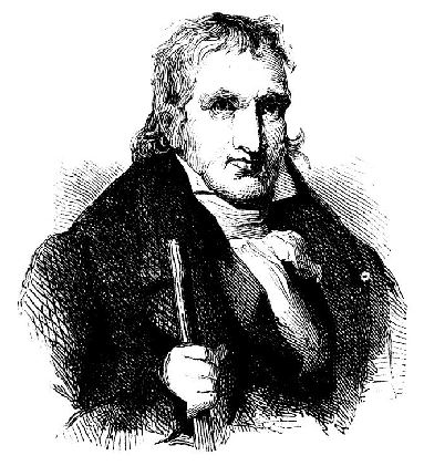 One of the first explorers of the Vermilion area was Simon Kenton (April 3, 1755 - April 29, 1836,) a famous United States frontiersman and friend of the renowned Daniel Boone, the infamous Simon Girty, and the valiant Spencer Records. Simon Kenton was born in the Bull Run Mountains, Prince William County, Virginia to Mark Kenton Sr. (an immigrant from Ireland) and Mary Miller Kenton. In 1771, at the age of 16, thinking he had killed a man in a jealous rage, he fled into the wilderness of Kentucky and Ohio, and for years went by the name "Simon Butler."
Kenton served as a scout against the Shawnee in 1774 in the conflict between Native Americans and European settlers later labeled Dunmore's War. In 1777, he saved the life of his friend and fellow frontiersman, Daniel Boone, at Boonesborough, Kentucky. The following year, Kenton was in turn rescued from torture and death by Simon Girty.
Kenton served on the famous 1778 George Rogers Clark expedition to capture Fort Sackville and also fought with "Mad" Anthony Wayne in the Northwest Indian War in 1793-94.
In 1782, he returned to Virginia and found out the victim had lived and readopted his original name.
In 1784 Kenton chiseled his name, S. Kenton 1784, on a boulder about 2 miles south of the Vermilion River mouth on the southern border of the old Rossman farm in a spot about 600' east of the State Road.
Presumably, Kenton marked the boulder to substantiate his claim to a 4 square mile area surrounding the river mouth, a likely settlement someday. Kenton claimed similar areas throughout the State but lost his claims due to his lack of education. He was too early and too ignorant of drawing up legal claims of his discoveries.
We do have the satisfaction of knowing that he was the first to find and realize that the Vermilion River would some day be the nucleus of a growing community. How right he was!
In 1937 the Vermilion Centennial "Stone Committee" discovered the stone. The stone now stands as a memorial to Kenton at the Ritter Library.
Kenton moved to Urbana, Ohio in 1810, and achieved the rank of brigadier general of the Ohio militia. He served in the War of 1812 as both a scout and as leader of a militia group in the Battle of the Thames in 1813.
Simon Kenton had 6 children in his second marriage. Kenton died in New Jerusalem, Ohio (in Logan County) and was first buried there. His body was later moved to Urbana, Ohio.
He died a poor man and might have been governor if he had had the proper background. As it was, though, he was an outstanding explorer in the Ohio wilderness and his efforts added considerably to the opening of the country to the settlers.
The History Of Father's Day
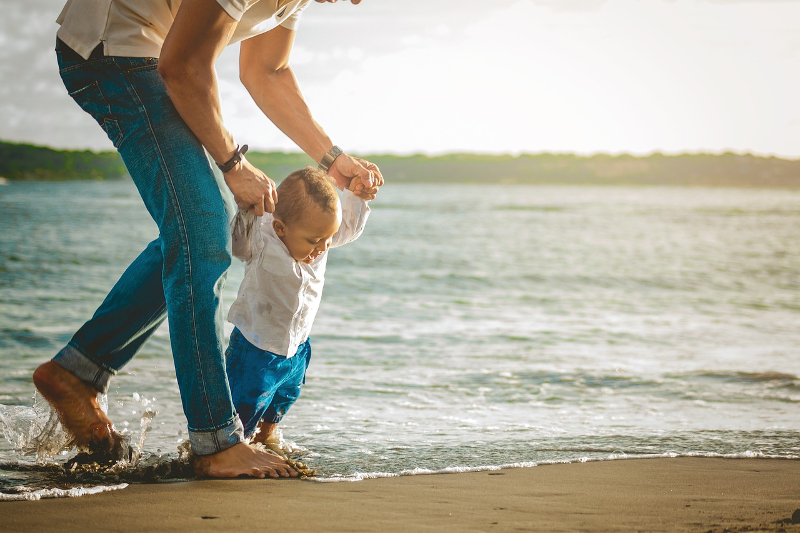 Sonora Dodd of Spokane, Washington, first proposed the idea of a "father's day" in 1909. Mrs. Dodd wanted a special day to honor her father, William Smart, a Civil War veteran who was widowed when his wife died in childbirth with their sixth child. Mrs. Dodd wanted to celebrate the strength and selflessness her father had shown in raising his children as a single parent.
The first Father's Day was observed on June 19, 1910. June was chosen because it was the month of William Smart’s birth. In 1924, President Calvin Coolidge supported the idea of a national Father's Day. However, the first presidential proclamation honoring fathers was not issued until 1966, when President Lyndon Johnson designated the third Sunday in June as Father's Day. Father's Day has been celebrated annually since 1972 when President Richard Nixon signed the public law that made it permanent.
Father's Day has become a day to not only honor your father, but all men who act as a father figure. Stepfathers, uncles, grandfathers, and adult male friends are all honored on Father's Day.
Top Reasons To Go Local
 Why buy local? By choosing local and independent businesses, you not only enjoy a more personal experience, you help:
BUILD COMMUNITY
The casual encounters you enjoy at neighborhood–scale businesses and the public spaces around them build relationships and community cohesiveness. They’re the ultimate social networking sites!
STRENGTHEN YOUR LOCAL ECONOMY
Each dollar you spend at independent businesses returns 3 times more money to your local economy than one spent at a chain (almost 50 times more than buying from an online mega-retailer) — a benefit we all can bank on.
SHAPE OUR CHARACTER
Independent businesses help give your community its distinct personality.
YOU CAN BUY IT WHERE YOU TRY IT
Local stores enable you to try on and try out items before you buy — and get real expertise — saving your time and money.
CREATE A HEALTHIER ENVIRONMENT
Independent, community-serving businesses are people-sized. They typically consume less land, carry more locally-made products, locate closer to residents and create less traffic and air pollution.
LOWER TAXES
More efficient land use and more central locations mean local businesses put less demand on our roads, sewers, and safety services. They also generate more tax revenue per sales dollar. The bottom line: a greater percentage of local independent businesses keeps your taxes lower.
GET REAL VALUE FOR YOURSELF
Reader surveys by the Consumers Union repeatedly show independent businesses beating their chain competitors in overall customer satisfaction (and they often save you money).
ENHANCE CHOICES
A wide variety of independent businesses, each serving their customers’ tastes, creates greater overall choice for all of us.
INCREASE WEALTH OF RESIDENTS
The multiplier effect created by spending locally generates lasting impact on the prosperity of local organizations and residents.
CREATE JOBS AND OPPORTUNITIES
Not only do independent businesses employ more people directly per dollar of revenue, they also are the customers of local printers, accountants, wholesalers, farms, attorneys, etc., expanding opportunities for local entrepreneurs.
GIVE BACK TO YOUR COMMUNITY
Small businesses donate more than twice as much per sales dollar to local non-profits, events, and teams compared to big businesses.
ENHANCE LOCAL DEMOCRACY
Local ownership of business means residents with roots in the community are involved in key development decisions that shape our lives and local environment.
ENHANCE HEALTH OF RESIDENTS
Research shows a strong correlation between the percentage of small locally-owned firms and various indicators of personal and community health and vitality.
The History Of Memorial Day
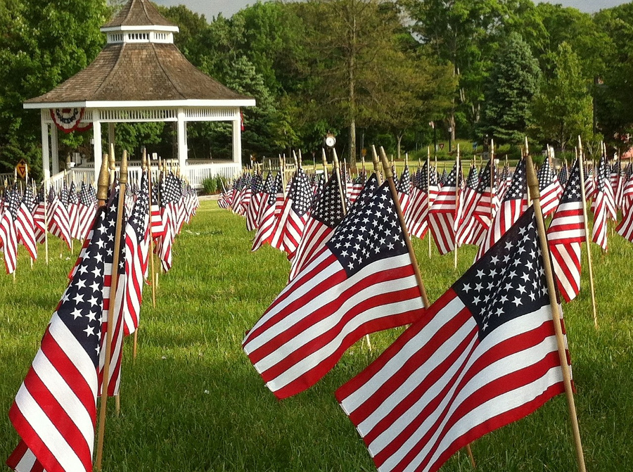 Memorial Day takes place on the last Monday in May to honor all those who died in American wars. The origins of the May holiday go back some 150 years.
In 1868, Commander in Chief John A. Logan of the grand Army of the Republic issued what was called General Order Number 11, designating May 30 as a memorial day. He declared it to be "for the purpose of strewing with flowers or otherwise decorating the graves of comrades who died in defense of their country during the late rebellion, and whose bodies now lie in almost every city, village, and hamlet churchyard in the land."
The first national celebration of Memorial Day (originally Decoration Day) took place May 30, 1868, at Arlington National Cemetery. The national observance of Memorial Day still takes place there today, with the placing of a wreath on the Tomb of the Unknown Soldier and the decoration of each grave with a small American flag. The holiday has changed a bit since it first began, which some argue was even earlier than Logan's dedication.
Southern women decorated the graves of soldiers even before the end of the Civil War. After the war, a women's memorial association in Columbus, Mississippi, put flowers on the graves of both Confederate and Union soldiers in 1866, an act of generosity that inspired the poem by Francis Miles Finch, "The Blue and the Grey," published in the Atlantic Monthly.
In 1971, federal law changed the observance of the holiday to the last Monday in May and extended it to honor all those who died in American wars. People pay tribute not only with flowers but also with speeches and parades.
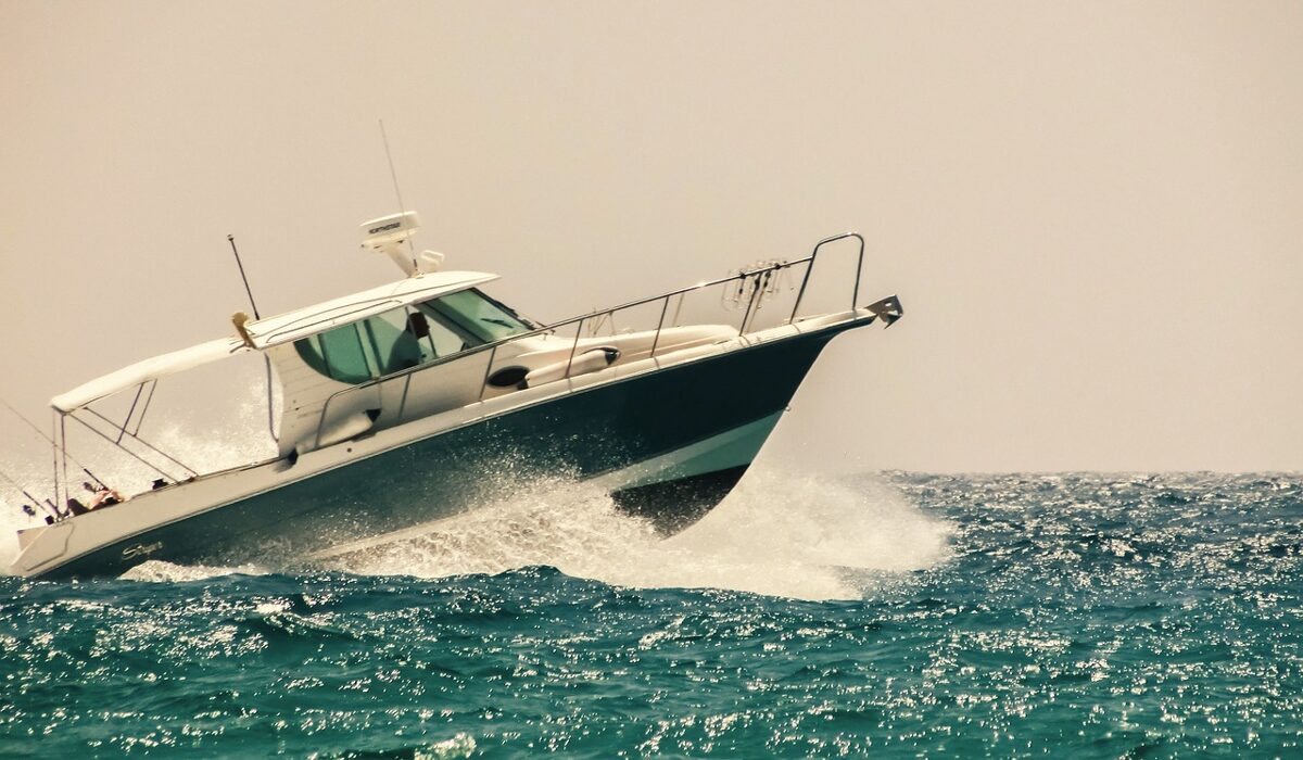
Boating Season Begins
 Vermilion, Ohio's boating season has arrived. ODNR strongly encourages Vermilion boaters to take a refresher boating education course this boating season.
According to U.S. Coast Guard’s statistics, in one year alone there were 4,291 recreational boating accidents that involved 658 deaths, 2,629 injuries and approximately 46 million dollars of property damage. Over 80% of these deaths occurred on boats where the operator did not receive boating safety instruction.
“Taking a boating education course is the first thing everyone should do before they go boating. These courses teach you about navigation rules, laws that must be followed in your state and provide safety checklists that will go a long way in helping you and your loved ones have a fun and enjoyable boating season,” says Mark Brown, President of the National Association of State Boating Law Administrators (NASBLA). “Whether you are a first-time boater or have years of experience, there is always more to learn when taking to the water. Taking a boating education course is one of the best things you can do to prevent accidents on the water.”
Boater education is mandatory in Ohio for all boat operators born on or after January 1, 1982, who operate a boat powered by more than 10 horsepower. There are many options to fulfill the law, including online and home study courses. Ohio offers a wide variety of boating courses, making sure that there’s an appropriate course for every boater.
Check Off Your List
 Vermilion, Ohio boaters are breaking their boats out of storage. Check out this general check list to begin your preparation for boating.
Review your boating registration: Boating registrations are required for every recreational boat in Ohio, including powerboats, sailboats, canoes, kayaks, pedal boats, and inflatable boats. Check your registration to make sure it isn’t expired. Boat registrations are good for three years and expire on March 1st.
Restock safety equipment onboard: The safety equipment required for your boat depends on the type of propulsion and length of your boat. A few general items needed across all vessels are a personal flotation device, visual distress signals, sound signaling devices, and lights. Check to make sure the required items are on board, functioning properly, and ready to use. Life jackets should be checked for wear and tear.
Schedule a vessel safety check: What better way to make sure you’re practicing safe boating techniques then an in-person safety check with a natural resource officer? Take an online virtual vessel safety check with the US Coast Guard Auxiliary, then schedule your safety check.
Plan your summer of boating adventures: Vermilion and the Buckeye State await your next boating adventure! Take this time before boating season begins to explore and plan your next trip.
Boat Ramp & Docks
 South Street Municipal Public Boat Ramp
Phone: (440) 204-2474
Location: The boat ramp is located on the west side of the Vermilion River, and is adjacent to the Water Pollution Control Center. Directions from Rt. 6: On the west side of the bridge over the Vermilion River, by Vermilion Deli & Grocery, turn south onto West River Road. Then in about ¼ mile at the stop sign, turn left (east) onto the Boat Ramp access road. Watch for oncoming traffic on West River Road from the south which does not stop and has the right of way. Directions from Rt. 60: From the traffic light where State Rt. 60 intersects South Street, turn right (east) onto South Street and go east about ½ mile. Where South Street dead-ends at West River Road, there is a stop sign. At this intersection, watch for traffic coming from the right (south) which does not stop and has the right of way. Cross the street by making a jog to the left (north) onto West River Road, then immediately turn right onto the access road leading downhill to the river and Boat Ramp.
Facilities
- 2 launching ramps
- 2 holding docks
- ADA kayak and canoe roller launch facility
- trailer and car parking
- disabled & handicap accessible facility
- open 24 hours year round
- bait and fishing supplies available from local suppliers
- minutes north to Lake Erie no dockage available
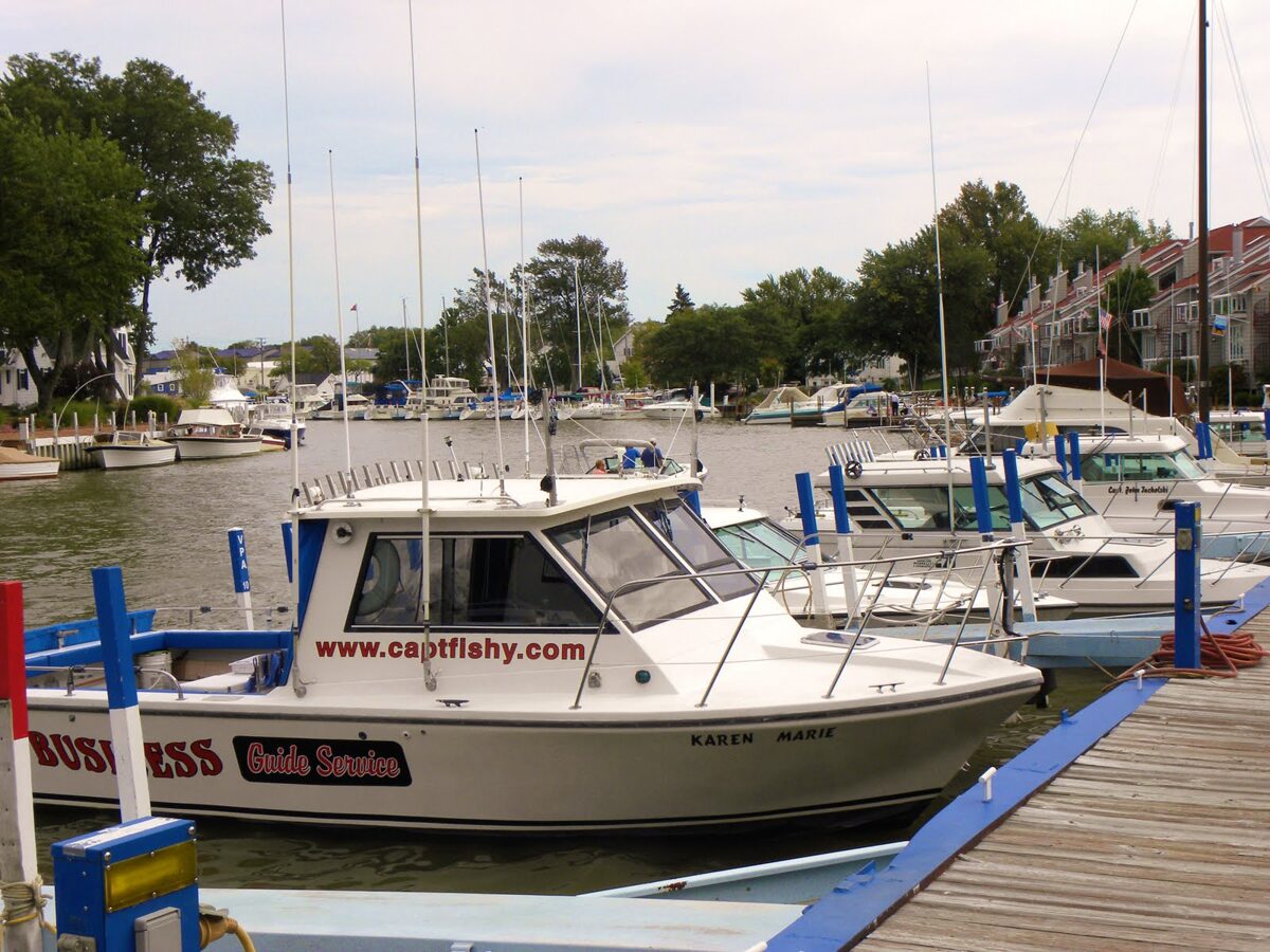 Water Works Public Guest Docks
Dockmaster: (440) 204-2474
We invite you to visit our Vermilion Public Guest Docks. You are in the center of Vermilion's historical district and within easy walking distance of many quaint specialty shops, groceries, ice, restaurants, fast food, historical homes, overnight accommodations, professional services and the beach.
Location: Just inside the Vermilion River harbor on the starboard side (West) you will find The Vermilion Municipal Water Plant. The docks are adjacent to the water plant.
Dockage
- Reservations suggested (contact Dockmaster (440) 204-2474)
- 20 guest berths accommodating both power and sail up to 45 ft.
- Facilities: water and electricity available, restrooms, showers, pump out
- Season: mid-May to mid-October
Nearby Facilities
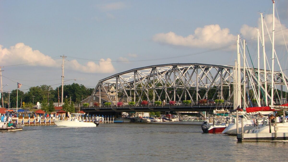
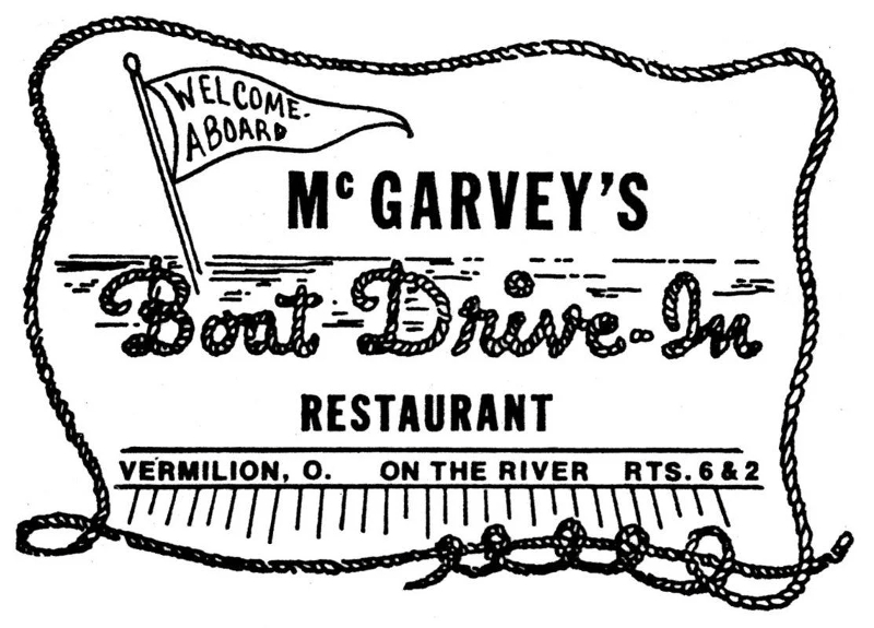
There are additional public docks at McGarvey's Landing (further up the Vermilion River, on the east side, just north of the bridge, at McGarvey's Landing next to the Quaker Steak & Lube Restaurant). Along the river, you will find marinas that provide fuel and services, as well as restaurants that cater to boaters' needs.
Harbor Info
- Harbor Master: (440) 967-6116
- Harbor Patrol: (440) 967-6116, Emergency 911
- U.S. Coast Guard: (440) 288-1206
- Local Police Monitor Marine Channel 16: CB 9
- Hospital: 20 minutes to Mercy Hospital (440-960-4000)
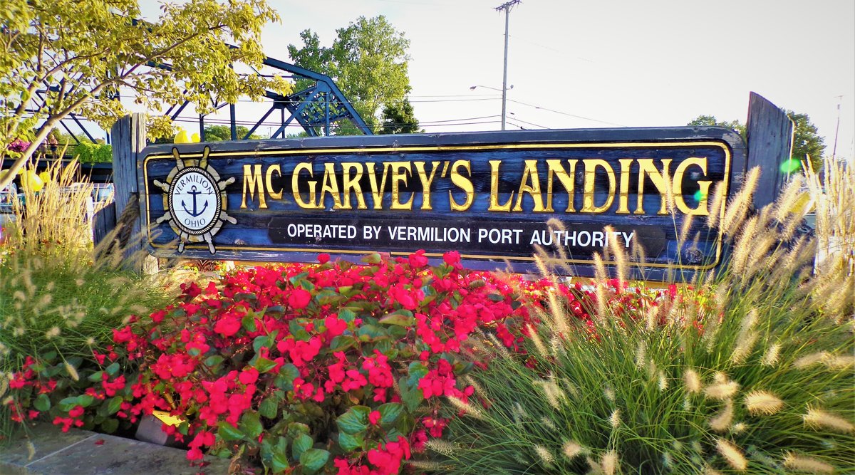 McGarvey's Landing
McGarvey's Landing features breathtaking views from the Vermilion River boardwalk in historic Harbour Town. Trees, beautiful planters, benches, picnic tables and more provide a wonderful park-like setting to watch boats sail along the river. Public boat docks are available along McGarvey's landing by the Vermilion Port Authority. All Port Authority guest docks are painted white with the top two feet painted a dark, royal navy blue. Many festivities take place at the boardwalk including rubber ducky races, lighted boat parades and crazy craft regatta.
Harbor Ordinances
- No wake
- 84 Decibel Noise Level Limit 24 Hours a day
The History Of McGarvey's
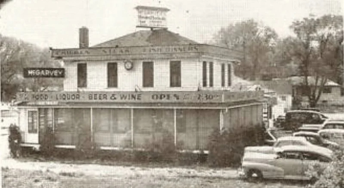 Many people do not know, or remember that the restaurant known as McGarvey's was originally built, owned and operated by Charles Helfrich. That was in 1929, shortly after the new bridge was built across the river. The old bridge crossed a little south of the present location.
 Mr. Helfrich operated a small boat and canoe rental business on the east side of the river. The proposed new bridge nearly touched his building and also diverted traffic away from it. So he purchased the land just north of the new bridge and built a restaurant and boat rental business there. Home cooked dinners, fish, chicken, sandwiches and homemade pies were the first attractions. Also served were the almost unheard of hot fish sandwiches, on Schwensen's bread. The business prospered and Helfrich's became a busy place. The canoe and boat business were also thriving. Canoeing on the river was a popular pastime in those days, especially on Sunday afternoons.
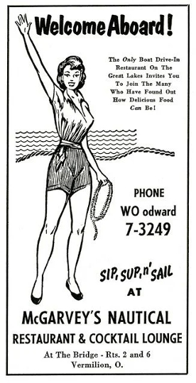 In 1934 Mr. Helfrich died and two years later Mrs. Helfrich sold the enterprises to Charlie McGarvey's. After his death, Mrs. McGarvey sold her husband's business to Eddie Solomon, son of Charles Solomon. The restaurant was one of the most well known eating places along the lake shore, popular with both "landlubbers" and boaters. In the year 2000, the Vermilion Port Authority purchased the McGarvey's property and razed the building. The property became a transient marina and restaurant named Red Clay on the River, now Quaker Steak & Lube.
Boat Safely
 Every year, millions of Americans take time to enjoy our Nation’s waterways — one of our great natural treasures. As warmer weather draws families to our Nation’s lakes, rivers, and beaches, this week serves as a critical reminder of the importance of staying safe on the water. Each year during National Safe Boating Week, the Coast Guard and an array of Federal, State, and local partners help save lives and guard against accidents by highlighting safe boating practices.
U.S. Coast Guard statistics show that drowning was the reported cause of death in four out of every five recreational boating fatalities in one year, and that 86 percent of those who drowned were not wearing life jackets.
“Don’t just have your life jacket close by, wear it,” said ODNR Director Mary Mertz. “If an accident occurs and you suddenly end up overboard, a life jacket will help keep your head above water and could save your life.”
New life jackets are much more comfortable, lightweight and stylish than the bulky orange style most boaters know. There are innovative options, such as inflatable life jackets, allowing mobility and flexibility for activities like boating, fishing, paddling or hunting, and are much cooler in the warmer weather.
The Wear It Ohio campaign encourages Vermilion boaters and water enthusiasts alike to always wear a life jacket when in or around water!
“We are excited to join forces with partners around the world to encourage everyone to wear a life jacket when on the water and always boat responsibly because the best boating experience is a safe boating experience,” said Peg Phillips, executive director of the National Safe Boating Council.
The Safe Boating Campaign reminds Vermilion boaters to follow these safety tips:
- Take a boating safety course.
- Wear a U.S. Coast Guard approved life jacket.
- Watch the weather.
- No distracted boating.
- Travel at safe speeds.
- Never boat under the influence.
- Have more than one communication device that works when wet.
Walking Tour Of Captains' Homes
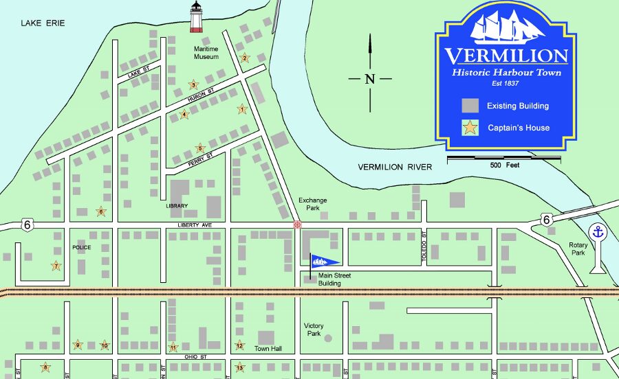 Vermilion was once known as the "Village of Lake Captains," and no other place has so many captains' homes in its historic district.
Vermilion was initially settled in the early 19th century and formed as a village in 1837. In 1840, the US Corps of Engineers finished building the tow piers at the mouth of the Vermilion which provided the depth builders needed to take boats into the lake. Thus began the "Golden Age of Ship Building" on the river, in tune with great demand for the shipping on the lakes. In a period of 36 years, 48 large lake schooners were built. Lumber, fish, sandstone, iron, and lime were major commodities at the time. The Captains of these vessels made Vermilion their choice as a homeport. As research continues, more Captains' homes are waiting to be discovered.
Captain Homes Tour
Please keep in mind that most of the captains' homes are private residences and not open to the public.
1. Captain Henry C. Leidheiser House, 566 Main Street, built 1890. Vernacular style.
2. Captain Fred S. Lawless House, 5604 Ferry Street, built 1902. Vernacular style.
3. Captain Charles A. Mattison House, 538 Main Street, built 1920. Craftsman style.
4. Captain Miles Thompson House, 485 Main Street, built 1830. Remodeled Greek Revival style.
5. Captain J.C. Gilchrist House, also known as Lakeside Inn, presently a Bed & Breakfast, 5662 Huron Street, built 1885. Italianate style.
6. Captain James F. Nolan House, 472 Washington Street, built 1911. Vernacular style.
7. Captain Alva Bradley House, Captain Alva Bradley House, 5679 Huron Street, built 1848. The captain was a good friend of Thomas Alva Edison. Greek Revival style.
8. Captain Charles Horton House, 5664 Ferry Street, built 1874. Gothic Revival style.
9. Captain George A. Bell Second House, 5790 Huron Street, built circa 1900. Vernacular style.
10. Captain Frank B. Parsons House, 5831 Huron Street, built circa 1915. Remodeled Vernacular style.
11. Captain Clifford H. Parsons House, 608 Decatur Street, built 1929. Vernacular style.
12. Captain Edwin R. Pelton House, 631 Decatur Street, built 1901. Queen Anne Style.
13. Captain Lewis Stone House, 5803 Liberty Avenue, built 1896. Vernacular style.
14. Captain Frederick Rae House, 690 Decatur Street, built circa 1870. Italianate style.
15. Captain Frederick Bailey House, 5775 Liberty Avenue, built 1911. Vernacular style.
16. Captain George A. Bell House, 5760 Liberty Avenue, built 1876, presently a Bed & Breakfast. Italianate style.
17. Captain William Young House, 5815 Ohio Street, built 1848, presently a Bed & Breakfast. Transitional Greek Revival style.
18. Captain Alva Bradley Second House, 751 Decatur Street, built circa 1870. Remodeled Stick style.
19. Captain Albert Meyer House, 756 Perry Street, built circa 1853. Captain Meyer was the master of the ill-fated “Western Reserve” which sank taking the lives of many Vermilion families. Italianate style.
20. Captain Leeds Weeks House, 5676 Ohio Street, built circa 1880. Queen Anne style.
21. Captain Peter G. Minch, 743 Grand Street, built 1857. Captain Minch was the owner of the ill- fated ship “Western Reserve”. Late Greek Revival with Italianate influence style.
22. Captain W.H. Gilchrist Sr. House, 5583 Ohio Street, built 1875. One of Vermilion’s few older brick buildings. Italianate style.
23. Captain William H. Moody, 792 Exchange Street, built 1903. Vernacular with Queen Anne influence style.
24. Captain Henry Walper House, 5475 South Street, built 1899. Queen Anne style.
25. Captain Charles Gegenheimer House, 910 Exchange Street, built circa 1898. Vernacular style.
26. Captain Frederick Hasenflue House, 5332 South Street, built 1907. Vernacular style.
27. Captain Peter Full House, 5118 South Street, built 1903. Remodeled Vernacular style.
28. Captain Cornelius Young House, 5231 South Street, built circa 1880. Vernacular style.
Prepared by the Vermilion Historic Register Committee of Main Street Vermilion.
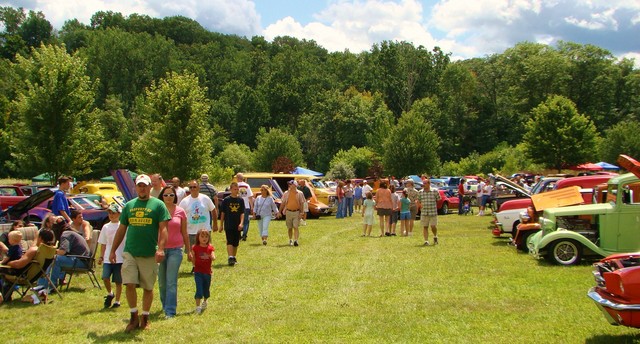
Vermilion Attractions & Events
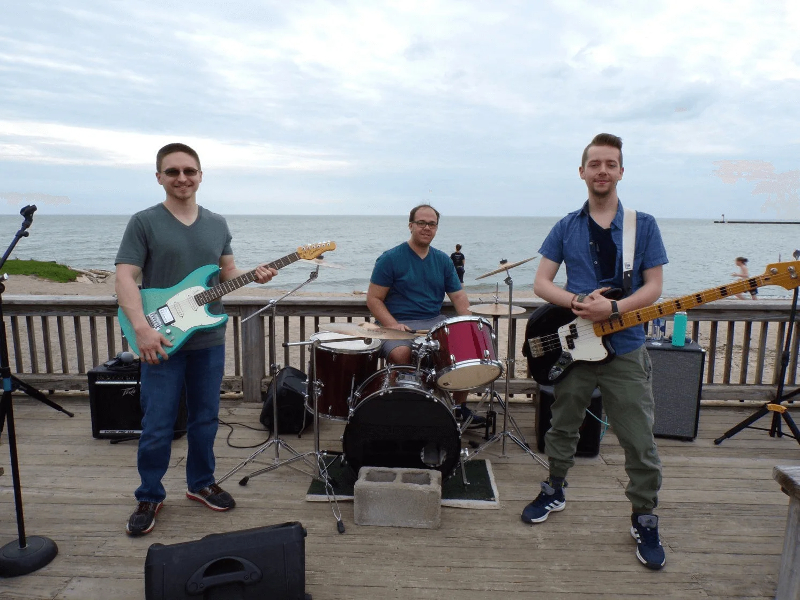 Third Thursdays provide an array of live music for your listening enjoyment in several different locations throughout town. The Vermilion Market offers locally grown produce and products, local cottage industry products, art, and local crafted items. Watch as the roads and walks along Vermilion's Main Street fill up with bright chalk drawings created by local artistic talent at Chalk it Up!
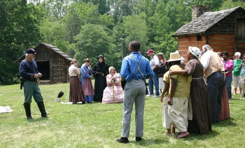
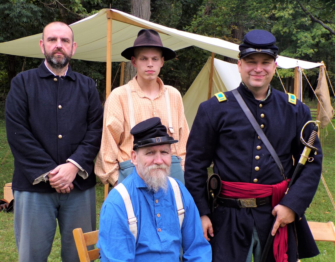 Civil War Days offers food, an open fire, crafts, demonstrations, music entertainment, and touring the historic Benjamin Bacon Homestead of 1845. The Annual Vermilion Ice-A-Fair is a day-long winter event for the entire family filled with glistening sculptures, ice carving demos and more! Art shows are planned throughout the year. Additional events include summer concerts, the Annual Chocolate Festival, the Annual Gardeners Fair, the Annual Duck Dash 500, the Vermilion River Watershed Open House, and much, much more.
Trails, Routes & Tours
Vermilion is located on the Lake Erie Coastal Ohio Trail, the Wing Watch & Wine Trail, the Back Roads & Beaches Bike Route, the Lake Erie Circle Tour and the Shipwrecks & Maritime Tales of Lake Erie Coastal Ohio Trail. The area's largest vineyard and winery is located on Vermilion's South Side.
The Reservation
Spanning two adjacent areas separated by the Vermilion River—Mill Hollow on one side and Bacon Woods on the other—Vermilion River Reservation is a favorite of picnickers, naturalists and anyone who just wants to enjoy its natural beauty. Just next to the Bacon House Museum, the Carriage Barn offers visitors information about the park and hosts nature programs. Vermilion River Reservation is located at 51211 North Ridge Road, just 4 miles south of downtown Vermilion, by the intersection of North Ridge and Vermilion Roads.
Arts & Culture
The Arts Guild features rotating exhibits of a new Artist of the Month, as well as special art shows and events. A wealth of art galleries abound in the Harbour Town district. The Vermilion Community Music Association, which features the Community Band, Community Chorus, and the Wind Jammer Dance Band, provides professional music services to numerous events throughout the year. The Vermilion Opera House, built in 1883 in the Vermilion Town Hall, is being restored to house a premier performing arts center featuring high quality touring performers, local theater, music and community events. Ritter Public Library, which is the jewel of our community, provides cultural events, plays, speakers, book clubs, and educational programs to all levels of our community. Meeting and housing space is provided for the many non-profit activities and events in town.
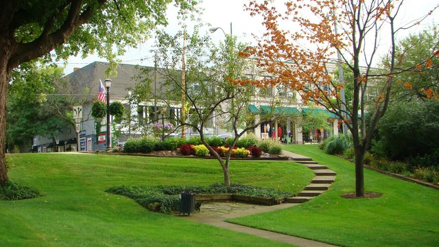
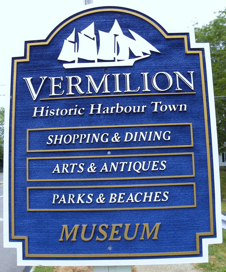
Historic Harbour Town
Harbour Town 1837 (historic downtown Vermilion) is home to dozens of retail shops, restaurants, professional businesses, marinas, accommodations and tourist activities. Visit Harbour Town by car or boat. Downtown public docks are within walking distance of a museum, dozens of boutiques, art galleries and fine dining. Harbour Town is also home to a beach and several parks. Enjoy the sandy beach, recreational boating of every kind, jet skis, canoeing, sailing and more where ship building was once the major industry. On summer nights, residents and visitors congregate on the large deck at Main Street Beach to watch boats sail back and forth in front of the beautiful Lake Erie sunset and enjoy the Mystic Belle, a small paddle wheeler, offering rides on the Vermilion River.
Harbour Town features events and entertainment throughout the year including sidewalk entertainment, artists, grand parades, festivals and bazaars. Summer months feature outside music and movies and weekly events. Winter offers an array of holiday activities and fabulous shopping bargains.
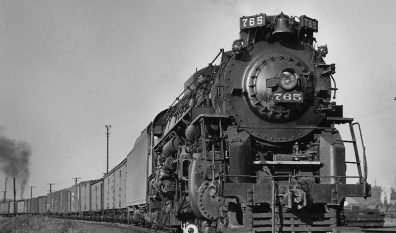
Railfan Destination
It doesn't get any better for rail buffs than Vermilion's historic downtown, with at least 5 trains racing through town every hour. The railroad action in Vermilion is virtually non-stop, and no other railroad town offers a more beautiful location in a picturesque town on the shores of Lake Erie.
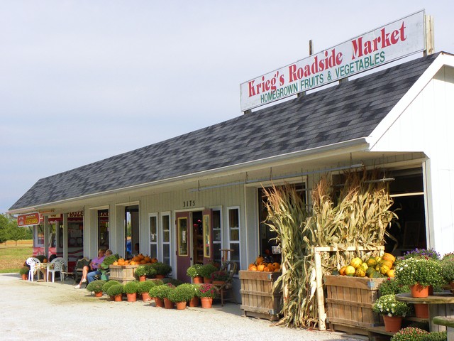
Roadside Stands
There is something special about preparing home-cooked meals with fresh fruits and vegetables picked up at a farm market within hours of harvest. Discover farm fresh foods at Vermilion's farm markets. Vermilion markets and roadside stands offer the freshest produce and seasonal favorites. From homegrown apples, lettuce, corn, beans, cucumbers, brocholi, radishes, cider, gourds, and fall squash - to a vast array of tropical fruits - you'll find everything you need for your cooking needs at Vermilion's own farmers markets and roadside stands. Visit area farms during one of the Pick Your Own seasons. Families and children gain the learning experience of where food comes from by Picking Your Own. Relax in the rural setting and soak in the fresh air and sunshine.
Historic Ballroom
In 1919 a group of investors from the Cleveland area purchased a wooded property with 600 feet of Lake Erie frontage in tiny “Vermilion-on-the-Lake”, Ohio. They cleared the land, and using the very logs they felled, built an approximately 10,000 square foot private community center known as the Vermilion-on-the-Lake Clubhouse. The big bands of that era were soon accompanied by couples dancing on polished hardwood floors beneath a glittering globe. Those original hardwood floors, framed by the original log walls, are still there today. The VOL (Vermilion-on-the-Lake) Historic Community Center remains today one of the only wedding venue's still situated on Lake Erie's shore. The 'VOL CLubhouse', as it has been called, demands only modest rental fees which assist the effort to save and renovate this historic building.
Vermilion Museums
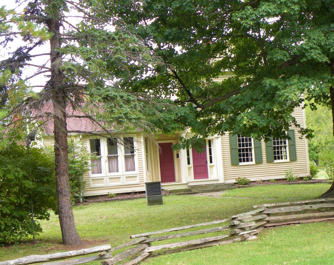 Vermilion River Reservation is home to the the picturesque Bacon House Museum at Mill Hollow. Walk through the original settler Benjamin Bacon's house, built in 1845. The museum features themes of daily living and puts an emphasis on the community life, including the profound effect the railroad had on the economy and on people's lives.
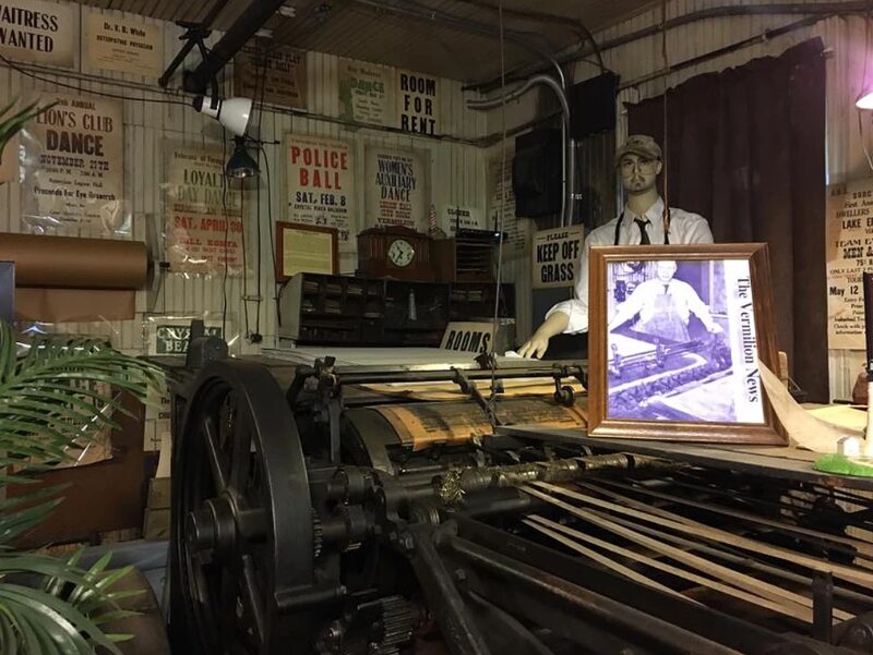
The Vermilion News Print Shop Museum, former home of Vermilion’s weekly newspaper 1905-1964, houses two linotypes and four letter presses as well as a collection of Vermilion photographs, signs, and other materials. The Vermilion Area Archival Society stores and indexes archival materials for research from the Vermilion area and provides assistance, as well as monthly programs, regarding the history and records of the area.
The Brownhelm Historical Association projects include the restoration of the Brownhelm Heritage Museum, the Historic Brownhelm School & Museum, and three local historic cemeteries (Brownhelm Cemetery, Brown’s Lake Road Cemetery, & Rugby Cemetery)..
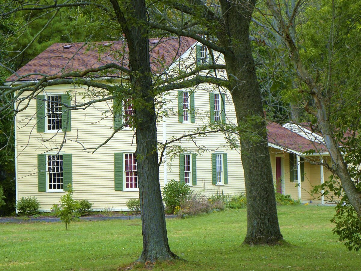
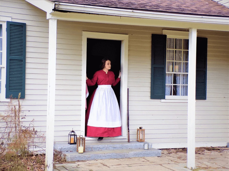
Bacon House Museum
Surrounded by tall trees and a split-rail fence, you can't miss the picturesque Bacon House Museum and Carriage Barn at Vermilion River Reservation's Mill Hollow. Walk through the original settler Benjamin Bacon's house, built in 1845. The museum features themes of daily living and puts an emphasis on the community life in Brownhelm, including the profound effect the railroad had on the economy and on people's lives. The museum is located at 51211 N. Ridge Road in Vermilion and is typically open on Sundays during during the Spring and Summers and during special events during the Fall and Winter. Call (440) 967-7310 for more information.
 The Bacon's
In 1817, Benjamin Bacon settled with his family along the top of the cliffs overlooking an oxbow in the Vermilion River that would eventually be called Mill Hollow. Soon afterwards, and at an early age, Benjamin was elected to the prestigious position of Justice of the Peace, and in 1824 was selected as one of the first commissioners for Lorain County. In 1835 he purchased an interest in a saw and grist mill that had been relocated to the oxbow in the river. A mill race was cut across the oxbow to increase the water power that turned the mill’s large water wheel. The mills were very successful and by 1845 had provided Benjamin the means to build a nice house across the road. When he died in 1868 at the age of 78, the house and mills were sold to John Heymann, a German immigrant new to the area.
Benjamin Bacon
Frederick Bacon was born in 1840, the youngest son of Benjamin and Anna, Benjamin’s third wife. In 1860, he enlisted in the Union army and fought in the Civil War for four years, after which he returned home to his wife Abigail (formerly Abigail Wells) and started a family in Brownhelm. In 1879, John Heymann sold the mills to Frederick Bacon. They’d been modernized with steam power after a fire destroyed them in October of 1876 which started after the close of business. Frederick now not only owned the mills, but also owned land in Geauga county and coal fields in Iowa. This diversity was very fortunate because with the advent of the railroad, fewer farmers needed to mill their grain locally and many local residents weren’t even farmers, but rather worked at the sandstone quarries instead. By 1901, the mills were no longer profitable and had to be sold and dismantled.
Frederick and Abigail Bacon
Frederick and Abigail had nine children, seven of whom never married. After Frederick’s death in 1901, his children continued to farm the river valley. By the late 1920s, only Sarah and Charles remained, and the house was rented to several people for decades until Charles’ death in 1957. Dorothy Bacon DeMuth, a distant cousin, inherited the property and donated it to the newly formed Lorain County Metro Parks. The Vermilion River Reservation became the first park in the Lorain County Metro Parks. The Bacon House was opened as a house museum in 1962 with the help of the Lorain County Historical Society. Today, the house is open Sundays and Holidays, Memorial Day to Labor Day, and scheduled private tours throughout the year.
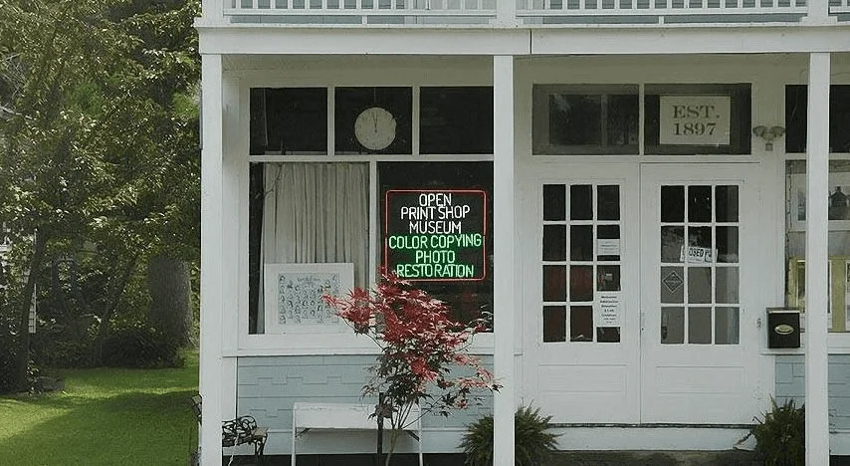
Vermilion News Print Shop Museum
The Vermilion News Print Shop Museum, in Downtown Vermilion, served as a print shop and a weekly newspaper from 1905 to 1964. The print shop houses two linotypes (c.1915), and 4 letter presses: A Stonemetz 2 revolution newspaper press (c.1919); a Kelly press (c.1917); a Chandler & Price 8"x12" Gorden Jobber Press (c.1900); and a Heidelberg windmill Press (c.1954). There is a book bindary and storage room with a manual paper cutter, electric stapler, and a manual hole punch machine.
 The building was built in 1904 by Caselton Roscoe of Milan, Ohio for his son and daughter-in-law, Pearl and Bessie Roscoe, to house the business. There is an apartment above the shop where the Roscoe's lived and raised their two daughters.
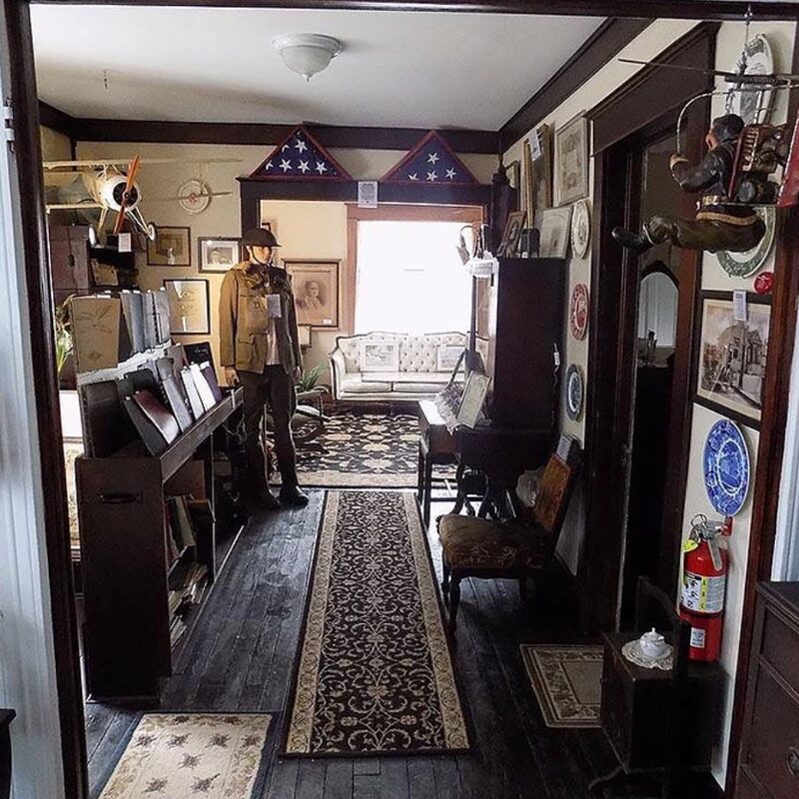 Today the apartment has become part of the museum featuring historical artifacts from the printer's family, as well as those from Vermilionites of the past.
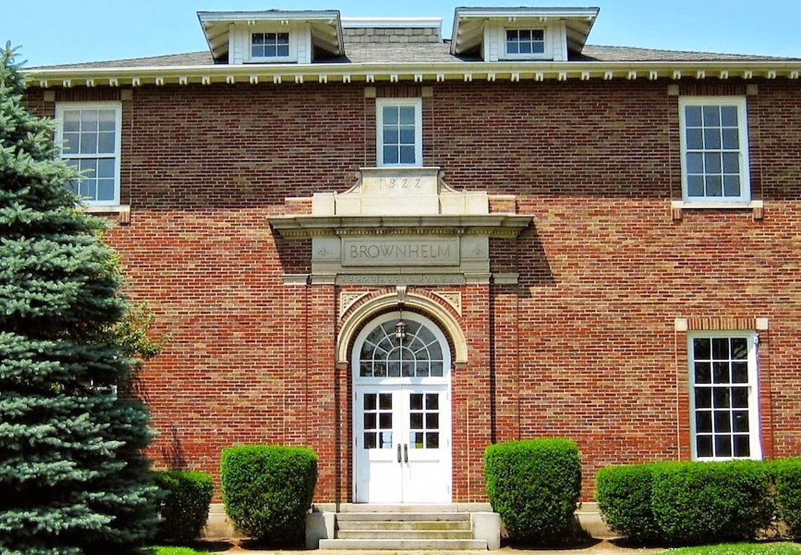
Brownhelm Museums
The Brownhelm Historical Association is renovating the former Brownhelm School (1889-1988) located at 1940 North Ridge Road. The Historic Brownhelm School & Museum offers a place for meetings, hosts the annual Brownhelm Community Christmas, provides events for the community, and hosts fundraisers such as the annual Grandma’s Attic Sale.
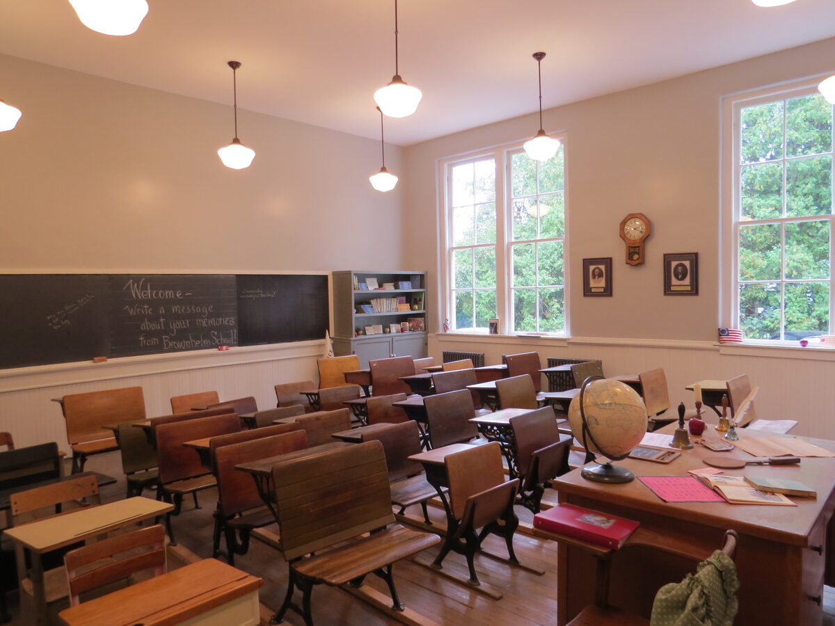 Upstairs classrooms house museum space displaying historical artifacts from the school’s past and from notable historical locations such as Swifts Mansion and the Light of Hope Orphanage.
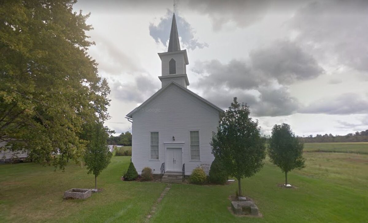 The Brownhelm Historical Association maintains the Brownhelm Heritage Museum at 1355 Claus Road, Vermilion. Built in 1870, it was formerly the German Evangelical and Reformed Church and was given to the association by its last 3 remaining members. The church was restored and it now houses many artifacts of Brownhelm history.
The History Of Vermilion Lagoons
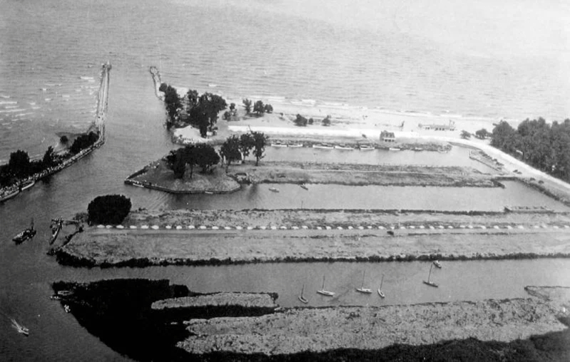 Louis Wells, a Cleveland contractor, began the Vermilion Lagoons project as a means of keeping his men busy during the Great Depression of the 1930s. By 1931 the first house and the beach house had been built and the lagoons were dredged and most of the wooden piling secured.
The first house was located just to the south and west of the beach house on the Erie Lagoon and belonged to a Mr. Comstock, a real estate salesman and employee of Wells Realty Company. A "building boom" took place in the mid 1930s and by 1940 all of the houses on Anchorage Way, at least one house on Willow Lane, and most of the houses on the portion of Portage Drive located on the north side of the Erie Lagoon had been constructed. The first year-round residents, the Lester Kishman family, moved into their new home in April of 1937.
The Lagoons was not mostly permanent residents until the 1950s. Another "building boom" began during this period and it was at this time that Park Drive, the last road to be developed, experienced growth. To the townspeople of Vermilion, the people of the Lagoons were often known as "swamp dwellers" or "swamp rats." They were also thought to be slightly crazy for wanting to live so close to the water. At times, this has indeed meant being in the water rather than by the water.
Along with the residential development came the recreational in the form of the Vermilion Yacht Club. Mr. Wells deeded the land on the tip and south side of Anchorage Way to the Yacht Club with one stipulation - no alcoholic beverages could be served or sold on the premises of the club itself. The originators of the Vermilion Yacht Club were all former members of the Cleveland Yacht Club seeking a more secluded anchorage.
Besides the obviously great boat dockage and the beach on the Lake, the uniqueness of the Lagoons is in the uniformity of the architecture of all buildings found there. The charm of Cape Cod homes, all white with dark roofs and shutters, amid trees (mostly all willows in the beginning) and fronting on lagoons is undeniable and gives to the Vermilion Lagoons its own inimitable flavor.
Vermilion Postcard Project
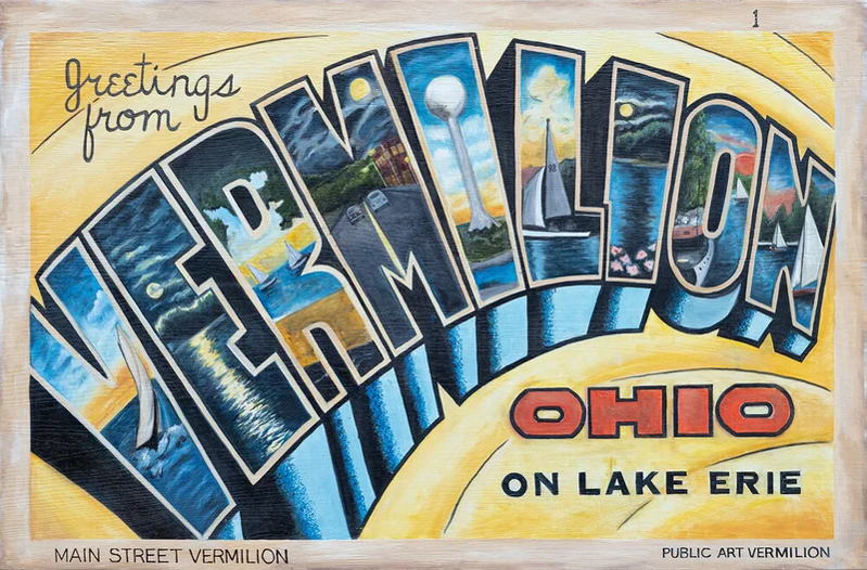 The Postcard Project features 15 big and beautiful, mural-sized recreations of vintage postcards that record local history and the nostalgic scenes that depict Vermilion as a long-time vacation destination. Enjoy a day downtown and all around Vermilion and see the award-winning Postcard Project for yourself.
Stop in at Main Street Vermilion first for your keepsake Tour Guide (a $5 suggested donation).
Postcards 1 through 10 are walkable throughout the historic downtown district.
Postcards 11-14 are located along the eastern corridor of town and can be viewed on foot or by car.
Postcard 15 is located 4.8 miles west of downtown at Beulah Beach, where the grounds are open to the public and the view of the lake is a wonderful way to end your day in Vermilion.
Main Street Vermilion is located at 685 Main Street in downtown Vermilion, Ohio. Call (440) 963-0772 or visit www.mainstreetvermilion.org for more information.